
Waterspouts and 10-minute storms: reading the sea's sudden mood swings
Calm one minute, a waterspout or squall the next — coastal weather can turn fast. Here's how to read the signs of sudden sea storms and waterspouts, and what to do to stay safe when they hit.
A beach can go from calm sunshine to a waterspout or violent squall in minutes — coastal and sea weather is prone to sudden, fast-forming storms, especially in warm, humid conditions. Waterspouts (rotating columns of air and water, essentially tornadoes over water) and rapid summer squalls catch people out, but they usually give warning signs if you know what to look for. Reading the sky and knowing what to do keeps you safe when the sea's mood turns fast.
This guide explains waterspouts and sudden coastal storms — why they form, how to read the warning signs, and what to do to stay safe when a rapid squall or waterspout develops.
- Coastal weather can change fast — calm to storm in minutes, especially in warm, humid conditions.
- Waterspouts are rotating air-and-water columns (like tornadoes over water); most are relatively weak but dangerous.
- Warning signs: fast-building towering clouds, darkening sky, sudden wind shifts, distant rumbles.
- Summer afternoon squalls and thunderstorms form and hit quickly, with lightning, gusts and rough seas.
- If a storm or waterspout threatens, get out of the water and off the exposed beach immediately.
- Check forecasts and watch the sky; leave at the first signs, don't wait.
Quick answer: how do you stay safe from sudden sea storms?
By watching the sky, heeding forecasts, and leaving early at the first signs. Coastal storms — including waterspouts (rotating columns of air and water) and fast summer squalls with lightning and gusts — can form and hit within minutes, so the key is to notice the warning signs (fast-building towering clouds, a rapidly darkening sky, sudden wind shifts and drops in temperature, distant thunder) and act immediately: get out of the water, off the exposed beach, and to solid shelter (not under isolated trees or umbrellas — lightning risk). Don't wait to see if it passes. Check the forecast before you go (especially for afternoon thunderstorm risk in warm weather), and treat the sea's sudden mood swings with respect — they can bring dangerous lightning, waterspouts, gusts and rough water very fast.
So sudden-storm safety is about vigilance and early action: watch the sky, check forecasts, and leave the water and exposed beach at the first warning signs of a building storm or waterspout. Acting early, not waiting, is what keeps you safe from fast-forming coastal weather.
What waterspouts are
A waterspout is a rotating column of air and water mist over the sea — essentially a tornado over water (or a tornado-like vortex). There are two main types: 'fair-weather' waterspouts (the more common kind, forming over warm water under building cumulus clouds, usually weaker and shorter-lived) and 'tornadic' waterspouts (associated with severe thunderstorms, stronger and more dangerous). They appear as a funnel or column connecting the sea surface to a cloud above, with a spray ring where they meet the water. While many are relatively weak, waterspouts can still be dangerous — capsizing boats, causing damage if they move onshore, and posing a real threat to anyone in the water or on a boat. They're common in certain warm, humid coastal areas (including parts of the Mediterranean, Florida and elsewhere) in the warm season.
So a waterspout is a tornado-like vortex over water, ranging from common weaker 'fair-weather' types to dangerous storm-driven ones. Recognising one — a funnel from cloud to sea with a spray ring — and treating it as a genuine hazard is important, as even weaker ones threaten boats and swimmers.
- A waterspout is a rotating air-and-water column — a tornado over water.
- 'Fair-weather' types (common, weaker) form over warm water; 'tornadic' types (from storms) are stronger.
- Even weaker ones are dangerous to boats and swimmers — treat all as hazards.
Why sudden storms form
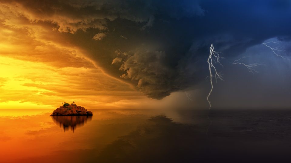
Fast-forming coastal storms are driven by heat, humidity and instability. On warm, humid days, especially in summer and over warm seas, the atmosphere can be unstable, and rising warm moist air builds towering cumulonimbus (thunderstorm) clouds rapidly — sometimes developing into a storm within an hour or less. These can produce lightning, strong gusts, heavy rain, rough seas and waterspouts, and can hit a beach that was calm and sunny shortly before. Coastal areas are particularly prone because of sea breezes, temperature contrasts between land and sea, and the warm-water heat source. The Mediterranean and other warm coasts are known for such sudden summer storms and waterspouts. So the same warm, humid conditions that make a lovely beach day also create the potential for rapid, violent storms.
So sudden coastal storms form from heat, humidity and atmospheric instability building thunderstorm clouds fast, aided by coastal sea-breeze and land-sea contrasts. Warm, humid summer conditions over warm seas are prime for these rapid squalls and waterspouts, which is why calm beach days can turn stormy quickly.
Reading the warning signs
Sudden storms usually give signs if you're watching. Look for: rapidly building, towering clouds (especially tall, cauliflower-like cumulonimbus with dark bases); a quickly darkening sky, particularly on one horizon; sudden shifts in wind direction or strength, and a noticeable drop in temperature (a gust front ahead of a storm); distant thunder or lightning (any thunder means the storm is close enough to be a lightning risk); and, for waterspouts, a funnel forming beneath a cloud or a spray ring on the sea. An increasingly choppy sea and darkening water can also signal changing weather. Noticing these — especially fast-building tall clouds and any thunder — gives you time to act before the storm hits. Keeping an eye on the sky, not just enjoying the sun, is the key habit.
So watch for fast-building towering clouds, a darkening sky, sudden wind and temperature shifts, distant thunder, and waterspout funnels. These warning signs precede most sudden storms, and spotting them early — by actually watching the sky — is what gives you the time to get to safety before the weather turns violent.
What to do when a storm threatens
When you see the signs, act immediately and decisively. Get out of the water at once (lightning is deadly and water is dangerous; waterspouts threaten swimmers and boats). Leave the exposed beach and seek solid shelter — a building or a car, not under isolated trees, umbrellas, or flimsy shelters, which attract or don't protect from lightning. Move away from the shoreline and any waterspout. Secure or abandon loose gear (umbrellas become dangerous projectiles in gusts). If on a boat, head to safety or shore per boating storm guidance. Don't wait to confirm the storm is coming — the whole point is that it can arrive in minutes, so leaving early, even if it turns out to pass, is the safe choice. Return only when the storm has clearly passed (wait out lightning, which can strike from a distance).
So when a storm threatens: out of the water, off the exposed beach, into solid shelter, away from the shore and any waterspout, immediately — and don't wait. Fast, early evacuation is the correct response to fast-forming coastal storms, since their speed leaves no time for hesitation once they're clearly upon you.
Prevention and awareness
The best defence is awareness before and during your beach day. Check the weather forecast before you go, especially the risk of afternoon thunderstorms in warm, humid conditions (common in summer), and be extra alert on days flagged for storm risk. During the day, keep half an eye on the sky rather than being oblivious, and note any building clouds or darkening horizon. Know the local pattern — some coasts (the Mediterranean, warm humid regions) are prone to sudden summer storms and waterspouts, so factor that in. Have a shelter plan (where you'd go). And respect that the sea's weather can change fast: a beautiful morning doesn't guarantee a storm-free afternoon, so stay aware and ready to act. This awareness, combined with early action, keeps sudden storms from becoming dangerous.
So prevent trouble through awareness: check forecasts (especially afternoon storm risk), watch the sky during the day, know your coast's storm tendencies, and have a shelter plan. Combining this forewarning with the readiness to leave early at the first signs is how you stay safe from the sea's sudden mood swings.
Before you go
- Check the forecast before you go, especially afternoon thunderstorm risk in warm weather.
- Keep an eye on the sky — watch for fast-building towering clouds and a darkening horizon.
- Note warning signs: sudden wind/temperature shifts, distant thunder, waterspout funnels.
- At the first signs, get out of the water immediately.
- Leave the exposed beach for solid shelter (a building or car), not under trees or umbrellas.
- Move away from the shoreline and any waterspout; secure loose gear.
- Don't wait to confirm the storm — leave early, and return only when it's clearly passed.
FAQ
What is a waterspout?
A waterspout is a rotating column of air and water over the sea — essentially a tornado over water. 'Fair-weather' waterspouts (common, weaker) form over warm water under building clouds; 'tornadic' ones (from severe storms) are stronger. Even weaker ones are dangerous to boats and swimmers.
How do coastal storms form so quickly?
On warm, humid days, especially over warm seas, unstable air lets rising warm moist air build towering thunderstorm clouds rapidly — sometimes within an hour — producing lightning, gusts, rough seas and waterspouts. Coastal sea-breeze and land-sea contrasts add to it, so calm beaches can turn stormy fast.
What are the warning signs of a sudden sea storm?
Rapidly building towering clouds (tall, dark-based cumulonimbus), a quickly darkening sky, sudden wind-direction or strength shifts and a temperature drop, distant thunder or lightning, and — for waterspouts — a funnel beneath a cloud or a spray ring on the sea. Any thunder means a lightning risk is near.
What should you do if a waterspout or storm approaches the beach?
Get out of the water immediately, leave the exposed beach for solid shelter (a building or car, not under trees or umbrellas), move away from the shoreline and any waterspout, secure loose gear, and don't wait. Fast, early evacuation is essential, as these storms arrive in minutes.
Are waterspouts dangerous?
Yes — while many fair-weather waterspouts are relatively weak, they can still capsize boats, cause damage if they move onshore, and threaten anyone in the water or on a boat. Tornadic waterspouts are stronger and more dangerous. Treat all waterspouts as genuine hazards.
Where do sudden summer storms and waterspouts happen most?
In warm, humid coastal areas during the warm season — including parts of the Mediterranean, Florida and other warm coasts, which are known for sudden summer thunderstorms and waterspouts. Check forecasts and stay alert to the sky in these regions especially.
Use BeachFinder to check today's spot.
Use your location, search any city worldwide or explore the map to compare the 20 most relevant beaches and swimming spots around you.
Download BeachFinder
Find beach conditions, sea temperature, wind, UV, water quality, and nearby swimming spots before you go.