Best beaches near Malaga: La Malagueta, Pedregalejo and the Nerja coves
City beaches, eastern fishing-quarter chiringuitos and Axarquia day trips from Malaga, with Cercanias logistics, parking reality and jellyfish notes for the Costa del Sol.

Malaga is one of the easiest Mediterranean cities for a beach trip because the coast is part of the city plan. La Malagueta sits walking distance from the cathedral and the Pompidou, and the eastern fishing quarters of Pedregalejo and El Palo continue the sand for several kilometers along the Paseo Maritimo. The catch is that the central beaches share a thicker, dark-grain sand and busier crowds, while the cleanest small coves require a Cercanias hop east toward Nerja and Maro.
Use this guide to match the day. La Malagueta and Playamar are the central walking-distance defaults. Pedregalejo and El Palo are the chiringuito-style local stretches with espetos de sardinas grilling on the sand. Nerja and Maro are the dramatic Axarquia coast day trip, with smaller coves and cleaner water. Each works at a different time and budget, and the terral wind from inland reorders the choice more than the temperature.
- La Malagueta is the realistic city default, ten minutes' walk from the cathedral.
- Pedregalejo and El Palo are the local chiringuito beaches reachable by EMT bus 11.
- Playamar and Bajondillo (Torremolinos) sit on the Cercanias C1 line for the easy west day trip.
- Nerja and Maro deliver the dramatic Axarquia coves; ALSA coach is the realistic transport.
La Malagueta and the central city beaches
La Malagueta is the closest sandy beach to Malaga's historic center, walking distance from the cathedral, the port and the Pompidou centre. The beach is about a kilometer long with a wide promenade, sun loungers for rent, lifeguards in summer and a steady chiringuito line for fried fish lunches. The sand is darker than the western Costa del Sol because of the river inputs, but the water is clean and the seabed slopes gently.
On the city's western edge, Playa de la Misericordia continues the central sand toward Torremolinos and absorbs less of the city tourist crowd. Both Malagueta and Misericordia are reachable on foot from the center, by EMT bus 3 or by the Paseo Maritimo bike path. Parking near the seafront is tight in summer; arrive by 10:00 or use public transport from the historic center.
- Playa de La Malagueta: walking distance from cathedral, full services, chiringuitos.
- Playa de la Misericordia: western city continuation, less central crowd.
- EMT bus 3 and 11: cover the central and eastern beach strip.
- Paseo Maritimo: continuous promenade and bike path along the coastline.
Pedregalejo and El Palo: the eastern fishing quarters
East of Malagueta, the city continues along the Paseo Maritimo through Baños del Carmen, Pedregalejo and El Palo. These are the traditional fishing quarters where the chiringuito espetos de sardinas (skewered sardines grilled over wooden boats) became famous. The beaches are smaller, divided into bays by stone breakwaters, and have a more local Andalucian crowd than central Malagueta.
EMT bus 11 runs from Plaza de la Marina to El Palo every fifteen to twenty minutes and is the realistic transport. The smaller bay layout means parking is even tighter than at Malagueta, and the bus is faster. Pedregalejo beach in particular has a permanent local crowd of swimmers using the small bays year-round, which is a sign of the quality of the water and the protection from strong eastern wind.
Playamar and Bajondillo: the western Cercanias trip
Cercanias C1 line runs from Malaga Centro Alameda west along the coast through the airport to Fuengirola, stopping at Torremolinos. Playamar and Bajondillo are the two main Torremolinos beaches, reachable in about twenty to twenty-five minutes by train. They are wider than the central Malaga beaches, with paler sand and a full-resort feel: chiringuitos, sun lounger rentals, lifeguards, beach volleyball nets.
Bajondillo is the older, more compact Torremolinos beach below the cliff, while Playamar continues the same sand eastward with a more spacious feel. Both work as a longer half-day from Malaga and avoid the parking pressure entirely. The train runs frequently through the day; buy a single ticket at the station machine or use a Cercanias tarjeta for multiple trips.
- Playa de Playamar: wide sand, Cercanias C1 to Torremolinos.
- Playa de Bajondillo: compact, below the Torremolinos cliff, more central feel.
- Cercanias C1: Malaga Centro Alameda to Torremolinos in 20 to 25 minutes.
- Avoid driving the A-7 motorway west on summer Saturday mornings.
Nerja and Maro: the Axarquia day trip
Nerja sits about fifty kilometers east of Malaga along the Axarquia coast and delivers the dramatic small-cove Mediterranean that the city beaches do not. Playa de Burriana is the main Nerja beach, with chiringuitos, sun loungers and clear water tucked into a long curving bay. Playa de Calahonda is the photogenic small cove right below the Balcon de Europa lookout, more atmospheric and quieter outside peak season.
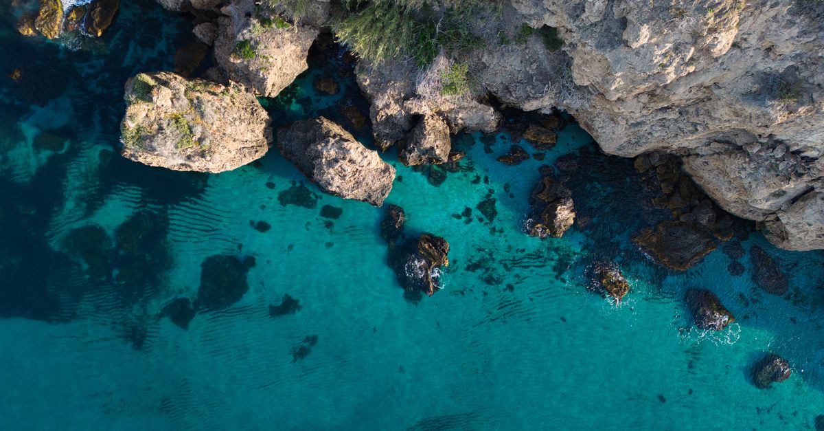
Maro, just east of Nerja, is the access point for the Cliffs of Maro-Cerro Gordo Natural Monument: small wild coves like Playa de Maro and the harder-to-reach Playa de las Alberquillas. The water here is among the clearest in the western Mediterranean. ALSA coach from Malaga bus station runs to Nerja in about ninety minutes, and a local taxi or summer shuttle reaches Maro. By car, the A-7 motorway is the fastest, around an hour outside peak summer traffic.
- Playa de Burriana (Nerja): main sandy bay, chiringuitos, lifeguard service.
- Playa de Calahonda: small cove under the Balcon de Europa, very photogenic.
- Playa de Maro: wild cove east of Nerja, cleaner water, fewer services.
- ALSA coach Malaga to Nerja: about 90 minutes, frequent daily service.
Winds, currents and jellyfish on the Costa del Sol
The dominant local wind is the terral from the north and inland, which dramatically warms the Malaga summer when it blows. Strong terral days can push temperatures past 40C and make the city beaches feel oppressive. The levante from the east occasionally arrives and brings chop to the central beaches, while the poniente from the west tends to keep the water cooler and clearer.
Pelagia noctiluca jellyfish events happen along this coastline between July and September, especially after sustained levante winds. Supervised beaches fly yellow caution flags when jellyfish are present. The Junta de Andalucia and Cruz Roja post warnings online. The Maro cliffs east of Nerja sometimes stay clearer when the central city beaches see a bloom; switching east is often the practical answer.
- Terral (N): hot inland wind, warms the city and the beach air, low impact on swimming.
- Levante (E): can push jellyfish blooms and chop onto central beaches.
- Poniente (W): cooler, clearer water, easier paddle conditions.
- Junta de Andalucia bathing-water dashboard: check flag colors before arriving.
How to actually plan the day without a car
For the central city beaches, walk from the cathedral or take EMT bus 3 to Malagueta and bus 11 east to Pedregalejo and El Palo. The Paseo Maritimo is a continuous bike path; rental bikes work well for a one-way beach tour with chiringuito stops. For Playamar and Bajondillo, take Cercanias C1 from Malaga Centro Alameda; the line runs frequently and is the most efficient way to skip the western coastal traffic.
For Nerja and Maro, ALSA coach from Malaga bus station is the realistic public option; trains do not directly serve Nerja. A rental car becomes more useful for the Maro cliffs because local taxis are limited outside peak summer. Plan the return for either before 18:00 or after 20:30 on summer weekends to avoid the slowest motorway peak.
Before you go
- Walk to Malagueta from the historic center; take EMT bus 11 east to Pedregalejo and El Palo.
- Use Cercanias C1 west to Torremolinos rather than driving the A-7 on Saturdays.
- Take ALSA coach to Nerja for the Axarquia day trip; plan Maro with a taxi or car.
- Watch for yellow jellyfish flags from July through September after sustained east winds.
- Try espetos de sardinas at a Pedregalejo or El Palo chiringuito on the eastern beach trip.
FAQ
Which beach in Malaga is best for first-time visitors?
La Malagueta is the realistic first-time default because it is walking distance from the cathedral, the port and the Pompidou centre, with full chiringuito and sun lounger services. For a more atmospheric local feel, take EMT bus 11 east to Pedregalejo or El Palo and try espetos de sardinas at a beach chiringuito. For a wider sandy bay with a different vibe, take Cercanias C1 west to Torremolinos for Playamar or Bajondillo; the journey is about twenty to twenty-five minutes.
Is Nerja worth the day trip from Malaga?
Yes, especially if you want the dramatic small-cove Mediterranean coast that Malaga itself does not offer. Nerja's Playa de Burriana is the main sandy bay with full services, and Playa de Calahonda below the Balcon de Europa is a photogenic small cove. East of Nerja, the Maro cliffs deliver some of the clearest water in the western Mediterranean. ALSA coach from Malaga takes about ninety minutes; a rental car opens up the harder-to-reach Maro coves and is worth it for a full day on the Axarquia coast.
Are jellyfish a problem on the Costa del Sol?
Sometimes. Pelagia noctiluca mauve stinger events happen along the Costa del Sol between July and September, especially after sustained east winds (levante). Supervised beaches fly yellow caution flags when jellyfish are present and red flags when swimming is closed. Check the Junta de Andalucia bathing-water dashboard and Cruz Roja notices before arriving. The Maro cliffs east of Nerja sometimes stay clearer when the central beaches see a bloom, so switching east is often the practical answer.
Use BeachFinder to check today's spot.
Use your location, search any city worldwide or explore the map to compare the 20 most relevant beaches and swimming spots around you.
These beach pages connect the guide advice with real spot details: sea temperature, wind, UV index, waves, access and photos when available.
Ondarreta
ES
Playa de Pedregalejo
ES
Playa del Regatón
ES
Platja gossos
ES
Playazo de Villaricos
ES
Playa Fluvial del Huerva
ES
Playa de Guadalmar
ES
la Caleta
ES
Praia das Furnas
ES
Praia de Rochas Brancas
ES
Platja de la Platera
ES
Platja dels Tres Micos
ES
Playa de Permenande
ES
Playa del Tranqueru
ES
Playa de Bolnuevo
ES