How to read a swell forecast and trust the right one
Wave height vs period vs direction vs wind: how to read a swell forecast, why two surf reports disagree, and what really tells you Saturday will be good.

Swell forecasts look like a wall of numbers and arrows. The good news is that most of those numbers describe the same idea from different angles, and once you know which two or three to read first, the wall becomes a useful conversation about Saturday morning. The bad news is that no forecast is right all the time, and two well-respected sources can disagree by a foot of wave and an entire wind direction on the same day.
This guide walks through the four numbers that actually decide whether a session is worth the drive, why models split, how to read multiple forecasts together and what a 'good day' looks like depending on what you ride. The goal is not to memorize models. It is to leave you with a way to look at a forecast for ten minutes and walk away with a confident plan.
- Wave height, swell period, swell direction and wind are the four numbers that matter; the rest is context.
- Period is the energy clue; a 1 meter / 13 second swell is more powerful than a 1.5 meter / 7 second swell.
- Direction decides which beach in a cluster will work; a coast that loves W swell will not work on pure SW.
- Two forecasts disagree because they use different ocean models, different bathymetry assumptions and different update cycles.
The four numbers that actually matter
Forecasts list a lot of fields. Most of them are decoration unless you already understand the four core numbers: wave height (how tall the average significant wave is), swell period (how many seconds between waves), swell direction (where the energy is coming from) and wind (speed and direction at the coast). Read those four together and you already have the bones of a session call.
Anything else - water temperature, secondary swells, tide phase - layers on top. They matter, but only after the core picture is settled. Surfline, Magicseaweed, Windy and the NOAA buoy network all rotate around the same four metrics, presented differently.
- Height: how big the wave will be at the beach, in meters or feet.
- Period: how organized and powerful the swell is, in seconds.
- Direction: which way the swell is travelling toward the coast.
- Wind: clean offshore, choppy onshore or light cross-shore at the surf time.
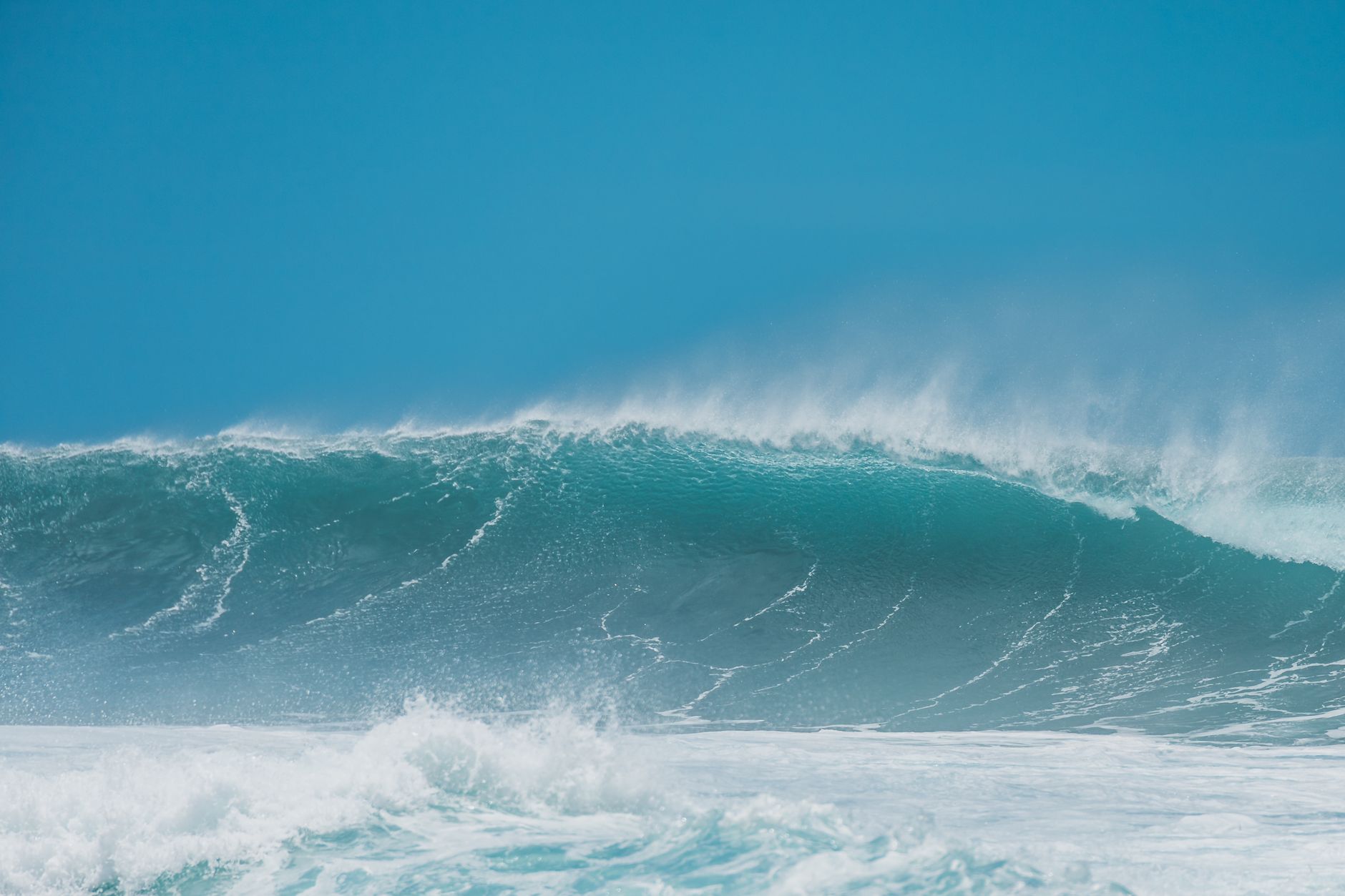
Why period explains 'real' size better than height
A common trap is to look at the height number and stop reading. A short-period swell (under 9 seconds) is often local windswell, born close to shore, lacking energy. It looks larger on paper but breaks weakly and quickly closes out. A long-period swell (12 to 18 seconds) was generated thousands of kilometers away, has organized in transit and arrives in clean, powerful sets even when the height number is modest.
Practically, a 1 meter / 13 second swell can produce a wave that surfs like 1.4 meters at the right beach, with the energy to wrap into bays and refract around headlands. A 1.5 meter / 7 second swell will often look messy and underwhelming. NOAA's NDBC glossary makes this distinction explicit by separating swell from wind waves at the buoy.

Direction is the geographic filter
Each coast has a window of swell directions it loves and another window it ignores. The Cote Basque is built for west-northwest groundswell. North Cornwall loves WNW. Ericeira fires on N and NW. Most coasts have detailed exposure diagrams that show which directions actually wrap into the beach.
If the forecast shows a swell direction outside the friendly window, even good height and period will not produce surf at that beach. This is also why beach clusters matter: a swell that misses one beach can hit a neighbor with a slightly different orientation. Use BeachFinder to compare exposures before settling on a single spot.
- A coast facing west works best on WNW to W swell.
- Bays and coves often clean up sloppy direction by refraction, but lose size.
- If the forecast direction is far outside the local window, expect a thin or non-existent swell.
Wind is the surface filter
Wind decides whether the wave face is readable. Light offshore wind (blowing from land to sea) holds up the wave and produces clean walls. Light cross-shore wind is workable. Onshore wind (blowing from sea to land) breaks down the wave shape and turns the surface into bumpy chop, especially uncomfortable for longboards and learners.
Forecasts split wind into hourly slots. A common pattern in Europe is calm mornings with offshore drainage, then onshore sea breeze building from late morning. That is why dawn patrols exist: same swell, different surface.
- Offshore: clean, hollow, harder to paddle out, ideal for shortboards.
- Cross-shore: workable, slightly textured, depends on the beach.
- Onshore: messy, choppy, usually a sign to switch beaches or wait.
Why two forecasts disagree on the same day
Surfline, Magicseaweed, Windy, Windguru, the European ECMWF model, the American GFS model and individual nation buoys all run on different physics, different ocean grids and different update cycles. A forecast that is recalculated every six hours with high local resolution will read a small developing low pressure system differently from one updated every twelve hours on a wider grid.
When two forecasts disagree, the practical move is to look at the buoy data closest to your coast (NDBC for the US, Puertos del Estado for Spain, MeteoFrance / Candhis for France, UK Met Office for the UK). Buoys measure what is actually happening rather than what models predict. If the buoy already shows the swell building, the more bullish forecast is probably right. If the buoy is flat, be more conservative.
- Compare two or three forecasts, not one.
- Cross-check with the nearest offshore buoy when forecasts split.
- Trust the buoy on the day, not the forecast from yesterday.
How to call Saturday morning with confidence
A practical Saturday call looks like this: late Wednesday, identify the swell event you are targeting (size, period, direction, ETA). Thursday, read at least two forecasts and the closest buoy. Friday morning, compare wind models for the time slot you want to surf. Saturday at dawn, look at the actual buoy and the live cam if there is one, then pick between the planned beach and one or two backups.
The confidence is not in being right every time. It is in having a system that catches the obvious mistakes. Most missed sessions come from looking at one number on Friday night and trusting it without context. Five extra minutes with the buoy and a backup beach saves more weekends than any single 'best' app.
Before you go
- Read swell period before height.
- Confirm the swell direction is in the friendly window for the beach.
- Plan around the wind window, especially morning vs afternoon.
- Cross-check at least two forecasts and the nearest buoy.
- Pick a backup beach in the same cluster with a different exposure.
FAQ
Why do two surf forecasts disagree about the same beach?
They use different ocean models, different grid resolutions and different update schedules. Surfline often blends in human forecaster judgment, while Magicseaweed and Windy lean more on raw model output. Disagreements are normal, especially around fast-moving low pressure systems. Cross-check with the closest offshore buoy on the morning of the session.
What period is good for surfing?
For most beach breaks, period from 9 to 14 seconds produces clean organized waves. Above 15 seconds you get serious groundswell power, which can be excellent for points and reefs but heavy for beginners. Below 8 seconds is usually local windswell that breaks weakly and closes out quickly. Match period to your level and the spot.
Is a higher wave always better?
No. A 1 meter / 13 second swell often surfs better than a 1.5 meter / 7 second one because the longer-period wave carries more energy and wraps into bays more cleanly. Beginners and longboarders specifically want moderate height with longer period. Bigger is only better if the spot, your level and the wind support it.
Use BeachFinder to check today's spot.
Use your location, search any city worldwide or explore the map to compare the 20 most relevant beaches and swimming spots around you.
These beach pages connect the guide advice with real spot details: sea temperature, wind, UV index, waves, access and photos when available.
Praia de Quarteira
PT
Playa de la Mata Negra
PT
Praia do Carvalho
PT
Plage Rive Gauche
FR
Plage de la Dalle
FR
Plage de Saint-Jean
FR
Praia dos Alemães
PT
Praia da Barra
PT
Plage du Lividic
FR
Lagoa de Albufeira
PT
Plage de Notre-Dame
FR
David
FR
Plage du Moulin Brûlé
FR
Praia dos Castelos
PT
Plage de La Folie Calette
FR